Bristle cone trail at MT. Charleston goes in a loop. and it has some great scenery.
The following information about the trail was taken from the US Forest Service site at
Bristlecone Trail
LENGTH: 5.2 miles round trip
ELEVATION: 8,470 feet to 9,380 feet
USE: Hiking, pack & saddle, biking
ABOUT THE HIKE:
- The beginning of the Upper Bristlecone Trail winds through a picturesque forest abundant with fir and large quaking aspen. As you climb out of the canyon, the vegetation becomes sparser due to harsher conditions and shorter growing season found on these more exposed slopes. It is here that you reach the rugged, stands of ancient Bristlecone pines.
- After two miles the trail widens and follows the abandoned WPA road. Follow this road for the remainder of the Bristlecone Trail.
- The route passes the junction with the Bonanza Trail then descends into a canyon as the Lower Bristlecone Trail. Stay on the abandoned road, pass through a small grove of aspen, and continue on until the roadbed ends at the lower Bristlecone trail head.
- Walk south up State Route 156 for ¾ mile to return to the upper parking lot of Lee Canyon Ski Area.
Upper Bristlecone Trail head
- Travel southwest on State Route 156 for 17 ¼ miles into Lee Canyon until the road dead ends in the upper most parking lot of the Lee Canyon Ski Area. The Upper Bristlecone Trail head is located on the west side of this lot.
- Head southwest on State Route 156 for 16 ½ miles into Lee Canyon . Turn right onto Scout Canyon Road 140 ft. north of the McWilliams Campground to reach the trail head. Ample parking is available at this trail head.
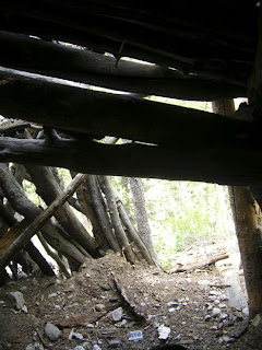
It was a great hike with wonderful scenery. As a matter of fact a little off the trail at one spot there was a little log shelter that it most likely used by skiers and snowboarder in the winter time. Considering that the upper trail starts at a ski area.
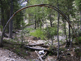
Archway on the trail
Along the trail
Thistle along the trail
Log Shelter
Inside Shelter
View from High point in the loop
Natalie On the trail
Another view
Once again it was a great hike. Although the whole thing was over 5 miles. So considering the dryness of the air and heat in the summer of this region. I encourage you to make sure you bring enough water. Especially since there is none in the summer time near the trail.
More hikes and Photos coming soon. Thanks for reading.


No comments:
Post a Comment